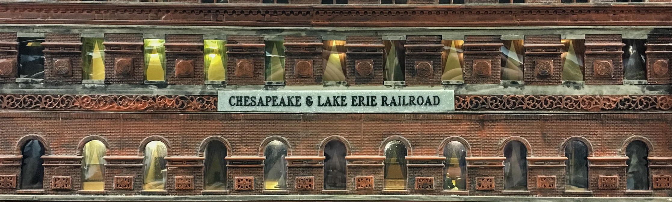
The Chesapeake System
The Chesapeake System is the HO scale model railroad of the North Shore Model Railroad Club. The Chesapeake is completely fictitious, but the routes and traffic patterns have been carefully thought out so that it would be a viable railroad in the real world. It is a large railroad and only a portion of it will actually be modeled. The model will represent a segment from Charleston, West Virginia, eastward across the Allegheny Mountains into the Shenandoah Valley of Virginia, then through the Blue Ridge Mountains and eastward across Virginia to a large seaport on Chesapeake Bay. The unmodeled portions of the Chesapeake are simulated by hidden staging yards and return loops which feed traffic to and from the modeled portion.
The Layout
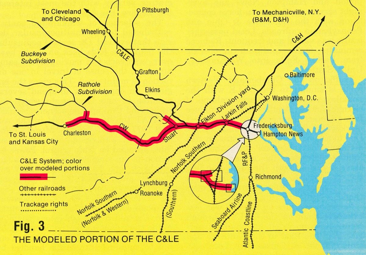
Where our Chesapeake System is located in Virginia / West Virginia. Diagram courtesy of Model Railroader.
The layout arrangement facilitates the use of walk around train control, which enables the engineers to stay close to their trains as they pass from scene to scene. This adds considerably to the feeling of operating a real train. At the present time, dispatching is by a radio system supplemented by train orders. In the near future, train movements will be governed by wayside signals controlled by two off-scene train dispatchers. They will remotely control signals and turnouts at passing sidings and junctions through a prototypical Centralized Traffic Control (CTC) machine. Engineers operating their trains will then have to observe and obey the wayside signals, and, just like the prototype, be at the mercy of the dispatcher's whims.
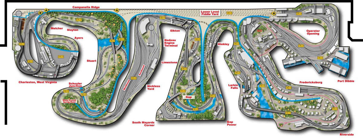
Diagram of the entire layout. Map courtesy of Scale Rails
After reaching the summit, the route enters the near side of the second and largest peninsula and begins the even steeper grade downward. This broad sweeping scene, visible from the aisle between the first two peninsulas, is a spectacular panorama of Appalachian Mountains and valleys requiring the CW to use many bridges and tunnels. During the course of passage through this area, the route passed the town of Ayres and Slayton. Small local industries, together with coal mines, provide local freights interesting switching operation. To further enhance operational interest, this portion is single track with two long sections of double track to allow trains to meet or pass. The Rathole subdivision is a large source of coal revenue serving some 15 different mines, and it joins the CW in Slayton.
At the foot of the long downgrade, an eastbound train passes through Stewart and then curves around the end of the second peninsula where it joins the C&LE's double tracked mainline from Chicago and the Great Lakes area. The C&LE westbound disappears up a steep walled river valley to a hidden return loop with two layover tracks and a connection to a behind-the-scene staging yard. The remainder of the eastbound journey occurs on C&LE rails. Also contained on this portion of the layout is the Buckeye subdivision serving several mines tucked into the mountains and some off-scene cities and towns. After swinging around the end of the peninsula, the main line passes by a large resort hotel complex patterned after White Sulphur Springs on the Chesapeake and Ohio Railroad. Besides a passenger station, it includes a freight house, power plant and tracks to store Pullmans and private cars. On the far side of the second peninsula is the large Nickless Division point yard located in the Shenandoah Valley near Elkton, Virginia. Large engine servicing facilities including a turntable and roundhouse occupy the area closest to the aisle.
Those of you who are familiar with the club will notice that the temporary return loop at the east end of Nickless Yard is gone and in its place is the new main line, all the way to Fredericksburg, Virginia and beyond. There is a major interchange and crossing at grade with Norfolk Southern (Norfolk and Western) as our main swings east and into the Blue Ridge. The Blue Ridge mountains are steep but narrow and are easily crossed via a water gap. Both sides of the water gap will be modeled on the curving end of the peninsula to look up the steep-walled valley. The far side of the peninsula will represent the Piedmont area and a transition into a more urban scene.
The west side of the fourth peninsula is occupied by Larkin Falls, a paper mill town, strangely reminiscent of Bellows Falls, Vermont. The main line of Norfolk Southern (Southern RR) crossed the Chesapeake system at grade near the center of town. There is also a small yard belonging to a branch line that leaves town over the dam, then winds its way back into the third peninsula where it serves a small town, large coal mine, lime stone quarry, and towns beyond (upper staging yard).
As the C&LE curves around the fourth peninsula and heads for Fredericksburg,it crosses a 500 foot long curved arch viaduct over the Rappahannock River and passes into a more industrialized territory. There is a large piggy-back facility, coach yard and manufacturing district served by a separate belt railroad.
Fredericksburg is the junction between the C&LE, which diverges to the South, and the C&H, which heads North to Mechanicsville, New York, and the D&H-B&M. The C&LE joins the RF&P, which provides our connections with the Seaboard and Atlantic Coastline in Richmond. A large passenger station patterned after Worcester, Massachusetts is located at the junction between the two main lines.
The Hampton News cutoff diverges from the C&LE just south of Fredericksburg and terminates at the large coal/ore marshalling yard and port facility at Hampton News on Chesapeake Bay. This is the Chesapeake system's coal export and ore import gateway. The C&LE and C&H main lines disappear from view on their last peninsula and wind their way to the staging yards.
A layout this large (approximately 95 x 30 feet) requires teamwork to succeed. We at North Shore are very fortunate to have a large group of capable, hard-working members intent on making the concept a reality. Come and visit us on Thursday evenings to see our progress.